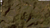
Step 1: go to Google Maps and zoom into to any part of the world that suits the terrain you want to use.
Ex. I prefer Philippine Jungle. Viola takes a few seconds.
Step 2: Press Print Screen to Screen Capture, then go to Photo Shop or GIMP and open "new" and past it on. Crop to get only the useful parts (including the reference scale).

Step 3: Go back to Google Maps and change the View from Satelite to Terrain. Screen Capture that and paste it on a layer over the first picture.

Step 4: Click on Multiply (which the image demonstrate) and manipulate Lightness/Darkness Levels (Ctrl+L in Photoshop).

Step 5: Make sure terrain depth and elevation markers are visible. Save as an Image. Resize to how big you plan to print it out.
Step 6: Go to http://incompetech.com/graphpaper/hexagonal/ and make a Hex PDF (line 0.1, 0.1 size hex). Get to your ideal proportions, you don't have to use the exact Google Earth values. Just use what is gamable.
Note: Locally tarp printing is around Php30-40 ($0.7-0.8) per sq foot. At 20 sq (7 x 3.33) ft it costs about Php800 ($16) for this tarp map. This one I made is 60m per hex. At the terrain difficulty it would roughly take 1 minute to cover at paced running through difficult terrain. You can extrapolate from there. (Paced running is Move x0.5, Difficult terrain is x0.5 move, moving at Light enc is x0.8 move, defaulting at Basic Move 5).

Here is the Rapid Share file.
Further note, you can play with Hues, to change the over all terrain and add props to represent goals, structures and vehicles.

2 comments:
Looks good. What method would you recommend for creating maps at a scale smaller than the highest zoom that Google maps offers? I'm thinking more along the lines of an encounter map suitable for minis rather than a large scale terrain map.
For encounter maps for dnd minis
Actually Ctrl+L (levels) manipulate contrast of Light and Darkness. So with the proper adjustments you can make the elevations seem lower (by not making it as dark as I did). This would be better for more to scale maps.
You will have to take some time to pick suitable terrain that is clear (well lit, not to dark shadows) and suits your purposes.
Use the Stamp Tool to remove stuff you don't like by taking a pattern from somewhere else and laying over the fixtures you want to cover up. Stamp will be one of your main tools for these tasks.
Then Use Filters,
- use blur to smooth over pixelations
- or use Paint, Fresco, and other syle-lized filters to make it look "drawn" or painted to obscure the low quality of the image source.
I'll provide an example soon (not today, I'm at work and had something else lined up )
Hope this helps.
Post a Comment